Subject: San Antonio, Texas
Period: 1935-41 (circa)
Publication:
Color: Black & White
Two uncommon pocket maps of San Antonio by the Southwell Map Company including:
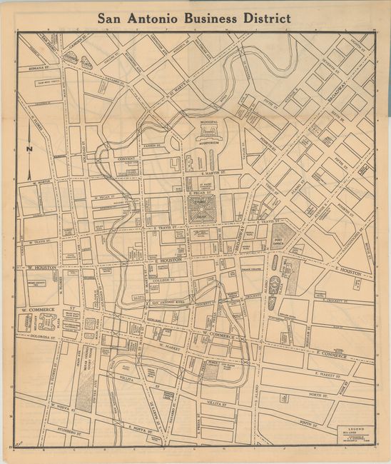
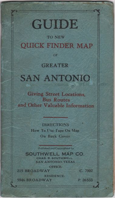
A. San Antonio Business District [on verso] Tourist Map of San Antonio [in] Guide to the New Quick Finder Map of Greater San Antonio Giving Street Locations, Bus Routes and Other Valuable Information, circa 1935 (13.7 x 15.6"). A basic map of downtown San Antonio identifying Travis Park, the municipal auditorium, public library, and more. A legend at bottom locates bus lines. Includes a "Tourist Map of San Antonio" on verso. 32 pages of text includes extensive detail on schools (white and colored), streets, subdivisions, bus lines, and more. Folds into paper wrappers (4.5 x 8.75"). Condition: Light toning with a few short fold separations. Paper wrappers have light wear and minor soiling (B+).
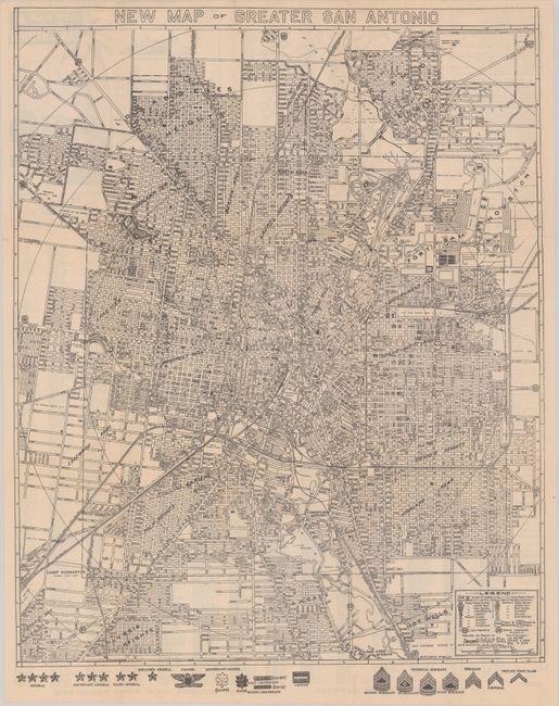
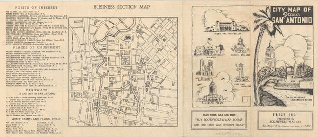
B. New Map of Greater San Antonio, circa 1941 (18.1 x 22.5"). A very detailed map identifying both public and Catholic schools, neighborhoods, and many places of interest, particularly related to the military. Verso contains an index and business section map. Circa date is inferred from text indicating the new airport was under construction, which was put into service in 1942. With an interesting “Buy War Bonds Today” appeal to preserve “Liberty and Christianity" on verso. Condition: On a bright sheet with a few small fold separations. (A)
References:
Condition:
See description above.