Subject: Texas
Period: 1864-82 (circa)
Publication:
Color: Hand Color
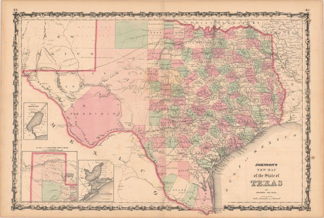
A. Johnson's New Map of the State of Texas, by Johnson and Ward, circa 1864 (24.6 x 16.8"). This large, handsome map shows county development mostly in eastern Texas and only the three large western counties of El Paso, Presidio, and Bexar in the west. The panhandle, noted as the El Llano Estacado or The Staked Plain (Elevated Table Land, without Wood or Water), includes a large section that is unorganized. Nice depiction of the wagon roads, many named, with several completed railroads including the Houston & Guaymas R.R. Insets include Plan of Sabine Lake, Plan of the Northern Part of Texas, and Plan of Galveston Bay. Decorative scrollwork border. Condition: Light offsetting and a few spots of foxing. (B+)
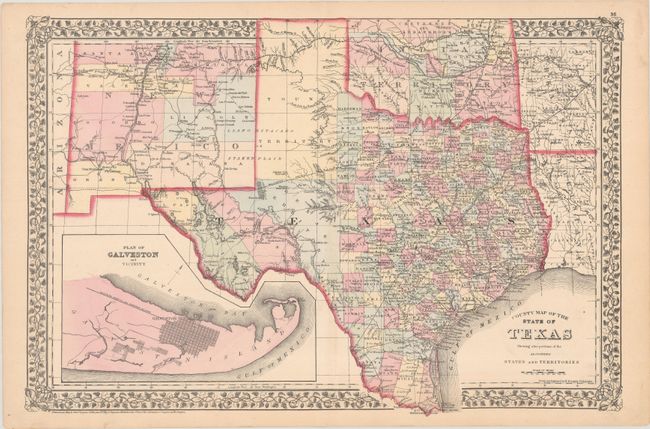
B. County Map of the State of Texas Showing Also Portions of the Adjoining States and Territories, by Samuel Augustus Mitchell, dated 1873 (21.3 x 14.3"). This fine double-page map of Texas extends to include most of New Mexico to above Santa Fe and the adjoining parts of Oklahoma, Arkansas and Louisiana. The map presents an excellent view of the county development with only the large regions of West Texas yet to be organized. Galveston’s role as a main port of entry is obvious as it is depicted in a large inset. The Llano Estacado, or Staked Plain, is shown extending from the New Mexico Territory through the Texas panhandle. Numerous railroads serve the southeastern part of the state with the future Southern Pacific R.R. shown as a dotted line from Dallas heading west toward California. Indian Territory is divided into several large Indian nations and reservations. The map is surrounded by Mitchell's distinctive grapevine border. Drawn and engraved in Philadelphia by W. H. Gamble. Condition: Near fine. (A)
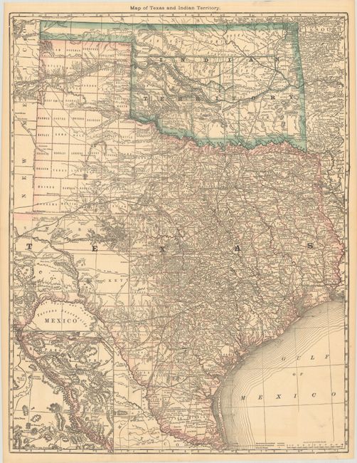
C. Map of Texas and Indian Territory, by Hiram H. Hardesty, circa 1882 (19.1 x 24.8"). A very detailed map of Texas and Indian Territory with an inset map of west Texas on the same scale. Shows good detail of roads, completed railroads, and projected railroads. Tom Green County is shown in a large, early configuration, not yet divided into Sterling, Irion, Coke, and Midland. In Greer County in southwestern Indian Territory two boundaries are shown: “Boundary Claimed by the State of Texas,” and “Boundary Claimed by the United States.” The dispute was ultimately decided by the Supreme Court which accepted the United States boundary and Greer County became part of the Indian Territory. From the 1882 edition of Hardesty’s atlas, before the Texas map was reduced in size. Condition: A hint of offsetting, otherwise fine. (A)
References:
Condition:
See description above.