Subject: Ohio
Period: 1820 (dated)
Publication:
Color: Black & White
Size:
16.3 x 19.1 inches
41.4 x 48.5 cm
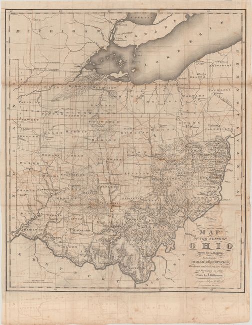
This scarce map resulted from the combined efforts of Alexander Bourne and John Kilbourne, both active surveyors in the early mapping of Ohio. It depicts 70 counties, including the recently organized counties in the northwest corner of the state. It also provides excellent topography, roads, towns, and forts with particular attention to Indian Reservations. At the top of the state is the disputed boundary with Michigan before the outbreak of the bloodless Toledo War of 1835 and 1836. That conflict occurred over a sliver of land called the Toledo Strip, a 468 square mile stretch of land that both Ohio and Michigan territory claimed as their own. They actually both raised militias and threatened each other from the banks of the Maumee River, but nothing more severe than taunting ensued. Michigan acquiesced to Ohio's border demands in order to be admitted to the Union in 1837, gaining the Upper Peninsula as a consolation prize. Issued in Caleb Atwater's Description of the Antiquities Discovered in the State of Ohio and Other Western States and in Transactions and Collections of the Archeologia Americana by the American Antiquarian Society.
References: Phillips (Maps) p. 627; Smith (The Mapping of Ohio) pp.167-168.
Condition: B
Issued folding with moderate offsetting, some toning along the folds, and numerous separations along the folds that have been closed on verso with archival materials. A couple 1" edge tears at right have also been archivally repaired.