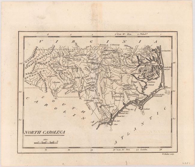
Subject: North Carolina
Period: 1801 (published)
Publication: Carey's American Pocket Atlas
Color: Black & White
Size:
7.7 x 5.8 inches
19.6 x 14.7 cm
Mathew Carey was a seminal figure in early American publishing; establishing the first publishing firm to specialize in cartography and issuing the first atlas devoted exclusively to American maps. He set up an elaborate cottage system of craftsmen for compiling, engraving, printing, and coloring maps. This practice was emulated by later American cartographic publishers such as John Melish and Henry S. Tanner. The American Atlas concept was also adopted by other publishers in both the United States and Europe.
An early map of the state showing the river systems, topography, and good coastal detail along the Outer Banks. Depicts an unnamed Great Dismal Swamp and an Alligator Swamp in the northeast corner of the state. This second state has been updated with important roads and place names that were not present on the 1796 edition. Engraved by William Barker.
References: Wheat & Brun #584.
Condition: A
A dark impression on a mostly clean sheet.