Subject: Maryland
Period: 1804 (circa)
Publication: A New and Elegant General Atlas
Color: Hand Color
Size:
9.7 x 7.9 inches
24.6 x 20.1 cm
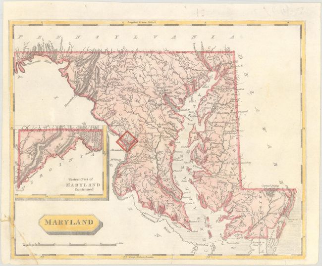
This early map of the state depicts all towns and villages, counties, roads, and extensive watersheds. County configurations are somewhat outdated with Frederick being the westernmost county, omitting both Washington and Allegany counties which were established in 1776 and 1789 respectively. Includes an inset of "Western Part of Maryland Continued" at lower left. Drawn by Samuel Lewis and engraved by Arrowsmith.
References: Phillips (Atlases) #702-46.
Condition: B+
Professionally backed with tissue to repair a chip at lower left with some minor adhesive residue on recto. A few short edge tears at bottom, one of which extends 0.5" into the image, have also been repaired.