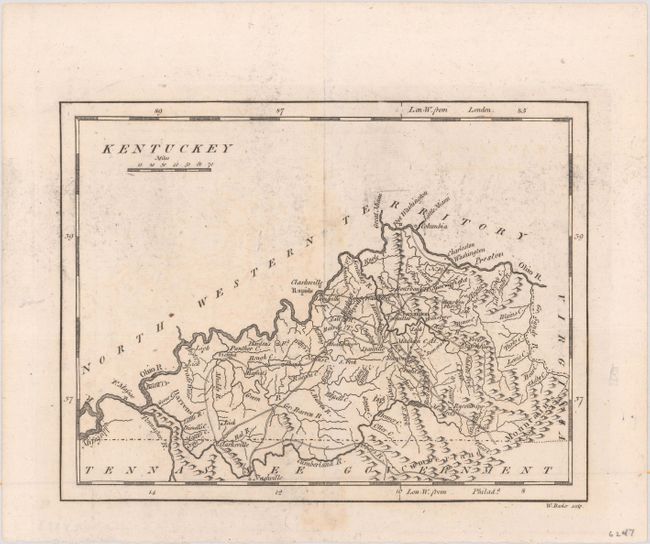
Subject: Kentucky
Period: 1801 (published)
Publication: Carey's American Pocket Atlas
Color: Black & White
Size:
7.7 x 5.9 inches
19.6 x 15 cm
Mathew Carey was a seminal figure in early American publishing; establishing the first publishing firm to specialize in cartography and issuing the first atlas devoted exclusively to American maps. He set up an elaborate cottage system of craftsmen for compiling, engraving, printing, and coloring maps. This practice was emulated by later American cartographic publishers such as John Melish and Henry S. Tanner. The American Atlas concept was also adopted by other publishers in both the United States and Europe.
This is the second state of this map with the addition of trails, roads, and several place names including Franklin and Shelbyville. In the northern portion of the state, Fort Washington is shown but not Cincinnati and Ohio is still part of North Western Territory. The eastern boundary with Virginia is on the western fork of the Big Sandy River rather than the eastern fork. Longitude is shown from London and Philadelphia. An attractive map with surprising detail for its size and early publication date.
References: Wheat & Brun #644.
Condition: B+
Minor staining along the centerfold and a bit of printer's ink residue.