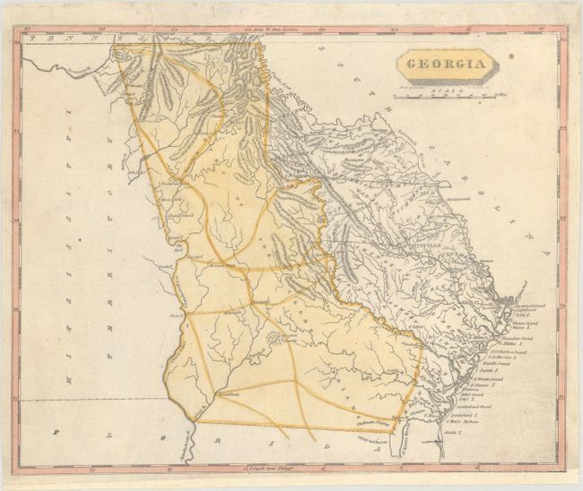
Subject: Georgia
Period: 1804 (circa)
Publication: A New and Elegant General Atlas...
Color: Hand Color
Size:
9.8 x 7.9 inches
24.9 x 20.1 cm
This handsome and important early map of the state features nice topographical detail. County development is current to roughly 1796, with the appearance of new counties Jackson and Wilkes, but no sign of Bulloch or Jefferson, which were formed the same year. The western half of present-day Georgia is still a possession of the Creek Indians. Rivers, swamps, roads (with distances), and towns and cities are identified, including Savannah and Augusta. It extends to show unengraved portions of Mississippi Territory, Florida, and South Carolina. Drawn by Samuel Lewis and engraved by D. Fairman.
References: Phillips (Atlases) #702-50.
Condition: B+
Professionally backed with tissue to repair a short edge tear at top. The bottom border has been reinstated at right with a small portion of border in facsimile.