Subject: Los Angeles, California
Period: 1926-31 (dated)
Publication:
Color: Printed Color
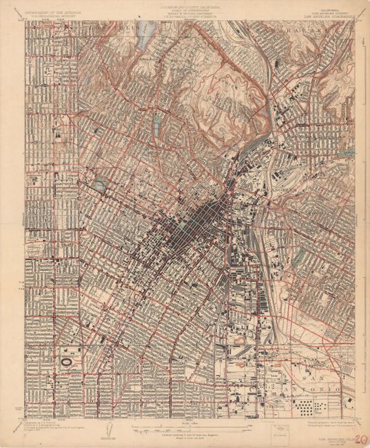
A. California (Los Angeles County) Los Angeles Quadrangle, dated 1931 (15.4 x 18.5"). A highly detailed map of downtown Los Angeles extending from Los Felis and San Rafael south to Exposition Park and San Antonio. Shows the major roads, railroads, and thousands of individual structures. Topography is depicted by tan contour lines and is concentrated to the north of the city around Elysian Park. Drawn on a detailed scale of nearly 3 inches per mile.
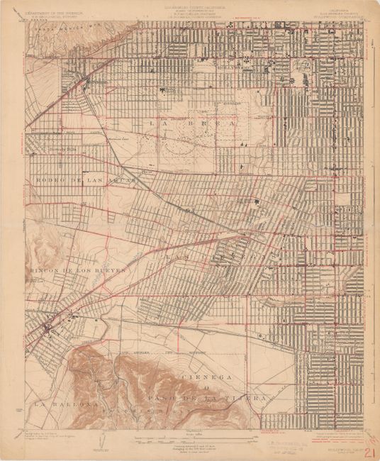
B. California (Los Angeles County) Hollywood Quadrangle, dated 1926 (15.1 x 18.3"). A detailed map extending from Baldwin Hills north to Beverly Hills and Hollywood. Shows the street grid pattern, railways, and individual buildings. Prominently depicts the Oil Wells and Fossil Pits at La Brea.
References:
Condition: B+
Each sheet was previously folded into quarters with manuscript number and tiny pinholes in the margins. The second map has a short fold separation confined to the lower blank margin that has been closed on verso with archival tape.