Subject: Los Angeles, California
Period: 1924-26 (dated)
Publication:
Color: Printed Color
Two early Hill pocket maps of Los Angeles including:
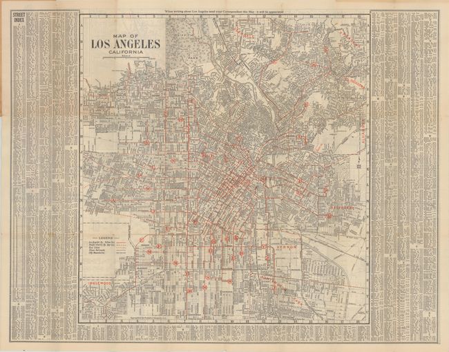
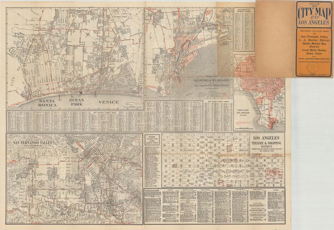
A. Map of Los Angeles California, by Franklin P. Borgnis, dated 1924 (26.8 x 21.0"). A detailed map of the city extending from Inglewood and Huntington Park north to Griffith Park and Pasadena. A legend identifies the lines of the Los Angeles Railway, Pacific Electric Railway, bus lines, railroads, and city boundaries. Surrounded by an extensive street index. Includes 5 additional maps on verso including Santa Monica, the San Fernando Valley, and the "Los Angeles Theatre & Shopping District." Folds into paper wrappers (3.8 x 7.5").
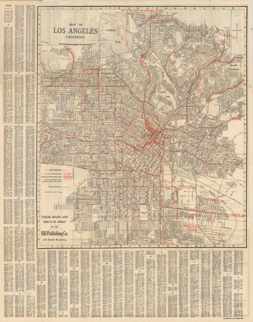
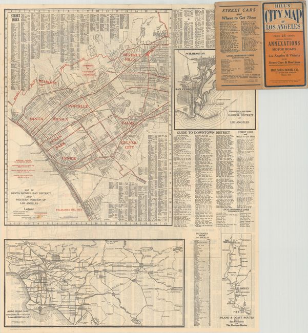
B. Map of Los Angeles California, by E.F. Hill, dated 1926 (18.4 x 21.1"). An updated version of the map above with slightly different boundaries. Railways are identified in red overprinting along with a "subway" (which opened in 1925). The verso contains four maps including the large "Map of Santa Monica Bay District and Western Portion of Los Angeles."
References:
Condition: A
Issued folding on clean sheets with a few tiny splits at the fold junctions. Minor wear to paper wrappers.