Subject: San Francisco, California
Period: 1875 (published)
Publication:
Color: Black & White
Size:
5.8 x 9 inches
14.7 x 22.9 cm
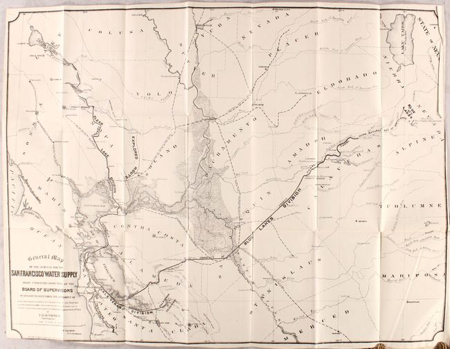
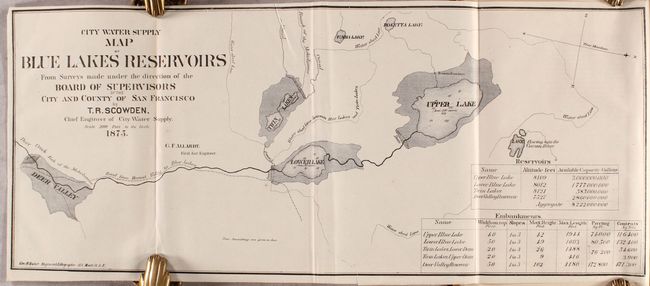
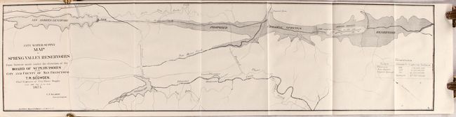
This 115-page report examines the water supply in the region surrounding San Francisco. From its earliest stages the water supply of the city was provided by private companies, especially the Spring Valley Water Works. City and county attempts to take control of the water supply resulted in a tense relationship and frequent litigation including company threats to cut off the water supply and government threats to use eminent domain to take control of the water supply. Numerous attempts from 1877 were made by the City and County of San Francisco to purchase the Company’s properties until a deal finally was struck in 1930. The volume is illustrated by the following six folding maps by T.R. Scowden with lithography by George Baker, a noted California artist and lithographer:
A. General Map of the Surveys for the San Francisco Water Supply... (30.4 x 23.0"). A large map extending from San Francisco to Lake Tahoe. Shows the water supply divisions, canals, conduit, reservoirs, an "explored route," and more.
B. City Water Supply - Map of Blue Lakes Reservoirs... (18.3 x 7.6"). Extends from Deer Valley to Upper Lake with water shed lines and canals located.
C. City Water Supply - Map of Clear Lake… (18.4 x 7.6"). A close up view of Clear Lake with a dam, tunnel, and canal at lower right.
D. City Water Supply - Map of Laguna de la Merced... (14.3 x 8.1"). Shows both the North Arm and South Arm of Lake Merced with a profile view from the pump house to the reservoir at right.
E. City Water Supply - Map of Calaveras Reservoir... (17.5 x 7.6"). Centered on the Alameda/Santa Clara County border, the map shows Calveras Creek and the proposed reservoir.
F. City Water Supply - Map of Spring Valley Reservoirs... (30.7 x 7.6"). Depicts the San Andres reservoir and the proposed Spring Valley reservoir with several dams and tunnels.
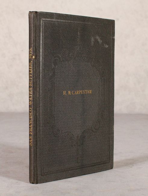
Printed by Spaulding & Barto, Steam Book and Job Printers in San Francisco. Octavo, hardbound in brown cloth with gilt title on spine and "H.B. Carpenter" on the front cover.
References:
Condition: A
The maps are overall clean, bright and near fine to fine with a binder's cut at bottom of the sheets. The large San Francisco Water Supply map has a 2" binding tear at right that has been closed on verso with archival tape, otherwise fine. Text is very good with a hint of toning and a few faint spots. Covers have only minor wear.