Subject: Southwestern United States
Period: 1878 (dated)
Publication:
Color: Printed Color
Size:
18.2 x 14.7 inches
46.2 x 37.3 cm
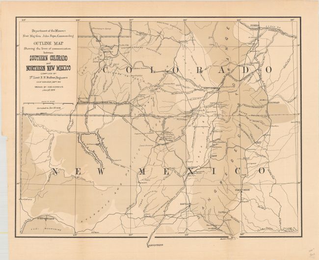
This map depicts the region from Pueblo to Albuquerque and Fort Defiance to just east of Trinidad. It was issued at the conclusion of Ruffner's 1873 expedition into Ute Country in order to quell the unrest between the Ute Indians and the prospectors in the newly discovered San Juan Mining Region. The map presents good topographical detail along with roads, proposed roads, railroads, towns, pueblos and more. First issued in 1876, this 1878 map includes revised information in a block of territory south of Animas and west of Pagosa. This edition was completely re-engraved without the use of hachure lines.
References:
Condition: B+
Issued folding on a clean sheet with a short binding tear at left that has been closed on verso with archival tape.