Subject: Southwestern United States
Period: 1860 (dated)
Publication: Sen. Doc. 1, 36th Congress, 2nd Session
Color: Black & White
Size:
32.6 x 23.2 inches
82.8 x 58.9 cm
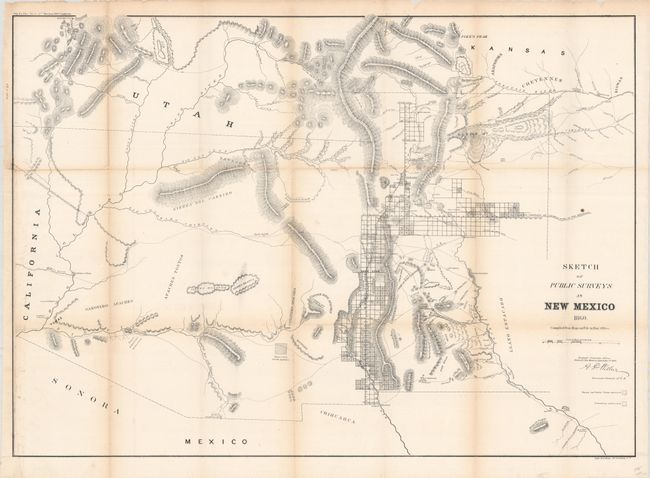
This early, large-scale, territorial map is by the Surveyor General's Office, Santa Fe, New Mexico, and is signed in plate by Surveyor General A.P. Wilbar. The map depicts the territory prior to Colorado annexing the San Luis Valley region. It extends to the Colorado River and north to Salt Lake City. It locates numerous Indian villages and reservations, extent of surveys completed including Pueblo claims, and subdivided townships. Limited and mostly inaccurate detail is shown in present day Arizona. It traces the Santa Fe Trail (wagon road to Ft. Leavenworth) and the wagon road to San Antonio. Good detail of springs, watershed, mineral locations, and mountains in hachure. An early version of an increasingly difficult map to obtain.
References:
Condition: B+
Issued folding and now flattened and backed with tissue. There is light toning along the fold lines and a binding trim at left that has been replaced with old paper and the border drawn in facsimile.