Subject: Northwestern United States
Period: 1852 (dated)
Publication: Sen. Ex. Doc. 1, 32d Congress, 2nd Session
Color: Black & White
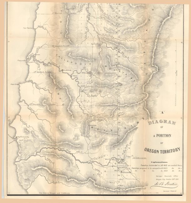
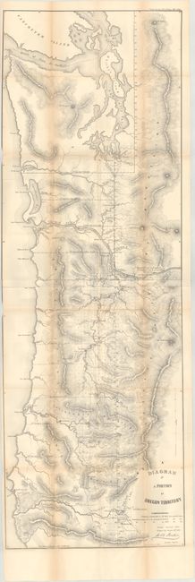
A. "A" Diagram of a Portion of Oregon Territory, (15.9 x 47.6"). This is the rare updated edition of the General Land Office's 1851 map of the coastal area of Oregon Territory printed on two sheets. The map spans from the California boundary north to Vancouver Island. It features good detail of rivers and tributaries and locates Portland, Oregon City, Astoria, Salem, Fort Vancouver, Santiam City, Winchester, Olympia, Pacific City, Umpqua, and several others. Mount Rainier, Mount St. Helens, Mount Hood, and various mountain ranges are identified. There is a lot of additional information in this revised edition, including intricate topographical detail, towns surveyed in 1852, and townships proposed to be surveyed in 1853 and 1854. The map is also expanded beyond the 1851 edition, extending to cover land north of Olympia. Lithography by A. Hoen & Co. Condition: Trimmed to the border at left with a few small edge tears and fold separations that have been closed on verso with archival tape. Light toning along the fold lines.
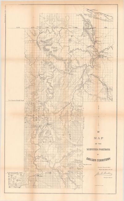
B. “B” Map of the Surveyed Portion of Oregon Territory, (15.1 x 25.4"). This early land office map details the central valley from Albany to Portland. Locates Marysville, Syracuse, Salem, Fairfield, Lafayette, Oregon City and Milwaukee. Locates Fort Vancouver across the Columbia River from Portland. Good detail of early wagon roads, watershed and topography. Signed in the plate by John B. Preston, the first Surveyor General of Oregon. Drawn in Oregon City on October 21, 1852. Also lithographed by A. Hoen & Company of Baltimore. Condition: There are a few small edge tears and fold separations that have been closed on verso with archival tape. Light toning along the fold lines.
References:
Condition: B+
Issued folding. See description above.