Subject: World
Period: 1758 (published)
Publication: London Magazine
Color: Black & White
Size:
17.3 x 12.3 inches
43.9 x 31.2 cm
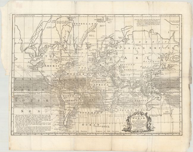
This detailed chart of the world was published in the February 1758 edition of London Magazine. Presented on Mercator's Projection, the map depicts the trade winds, magnetic variation, and recent discoveries around the world. Of particular interest is the depiction of the western coast of North America that presents a large West Sea. This is an early delineation of the Sea of the West based upon Delisle. To its north is a confusing series of landmasses based upon Russian discoveries in 1728 and 1741, divided by Bernarda River and Lake. In the South Pacific, New Zealand and Australia are shown with only partial coastlines, and Australia is still attached to New Guinea. A fascinating and detailed chart reflecting the latest knowledge.
References: Jolly #LOND-132; McGuirk #69.
Condition: B+
Issued folding on a bright sheet with a short binding tear at left and an edge tear in the top left corner of the image that have both been closed on verso with archival tape. A few minor fold separations have also been closed on verso with archival materials.