Catalog Archive
Auction 179, Lot 186

"Carte des Provinces Meridionales des Etats-Unis", Botta, Carlo

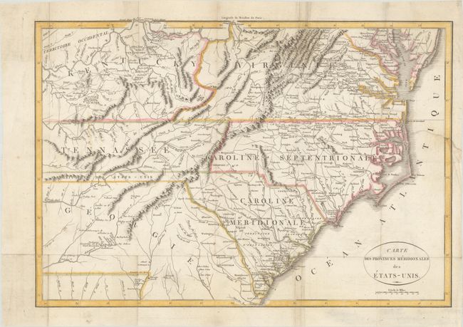
Subject: Southeast United States

Period: 1812 (circa)

Publication: Histoire de la Guerre de l'Independance des Etats-Unis d'Amerique

Color: Hand Color

Size:
19.4 x 13.5 inches
49.3 x 34.3 cm
Download High Resolution Image
(or just click on image to launch the Zoom viewer)

This map is from a French edition of Botta's Storia Della Guerra Dell’ Independenza... that covers all of the Carolinas with parts of Virginia, Kentucky, Tennessee and Georgia. Between Tennessee and Georgia is a long strip of land labeled United States Territory. This land originally belonged to South Carolina but was ceded back to the United States in 1787. Numerous Indian villages are shown, especially in the region of present-day Alabama. This map also appeared in the French edition of John Marshall’s Life of Washington.

References:

Condition: B+

Issued folding and now flat with professional repairs to a 3.5" edge tear at right and a short fold separation at top.

Estimate: $325 - $400

Sold for: $425

Closed on 9/16/2020

Archived