Subject: New Hampshire & Vermont
Period: 1802 (circa)
Publication: The American Universal Geography
Color: Black & White
Size:
9.1 x 7.3 inches
23.1 x 18.5 cm
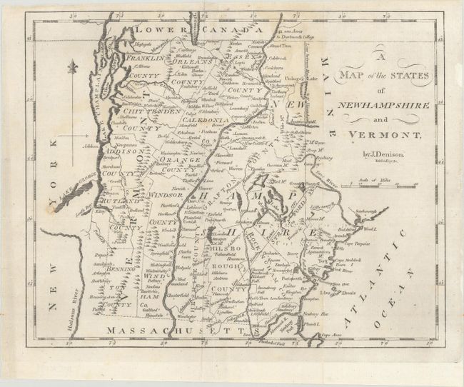
This nineteenth century map was drawn by J. Denison and published by Jedidiah Morse, one of the founders of American cartography. It shows five counties in New Hampshire and eleven in Vermont. The Line of Mason's Patent 1787 extends northeastward from Rindge, New Hampshire to the Maine border. Unlike the earlier edition originally published in 1796, this map includes the Line between Maine & N. Hampshire. This is the less common second edition, reengraved on a slightly smaller plate by Enoch G. Gridley.
References: cf. McCorkle (18th C. Geography) #304-3; cf. Wheat & Brun #188.
Condition: B+
Issued folding with a couple of archivally repaired fold separations and some minor staining. There is extraneous creasing and a small hole infilled with archival material at left.