Subject: North America, Texas
Period: 1839 (circa)
Publication:
Color: Printed Color
Size:
14.1 x 20.4 inches
35.8 x 51.8 cm
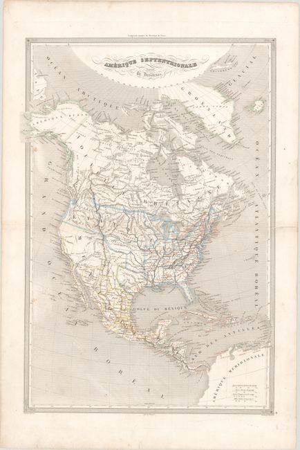
This scarce and detailed map features the Independent Republic of Texas. In Texas the only towns named are S. Antonio de Bejar, Ming, S. Felippe de Austin, and Nacodoches. The map uniquely uses orange overprinting to label some towns and to delineate the extensive wagon road network. It portrays the United States extending well into British Columbia, cartographically taking the side of the United States, as the French normally did at this time in history. Alaska is Amerique Russe, and all of Canada is Nouvelle Bretagne. Mexico controls the Southwest up to the District de Oregon. The map features good detail throughout including Indian names, watershed, railroads, forts, roads, etc. Fancy titling with flourishes, ruled border, and four distance scales embellish the map. Engraved by Dyonnet, with lettering by Benard. Printed by Mangeon.
References:
Condition: B+
Contemporary outline color with light soiling.