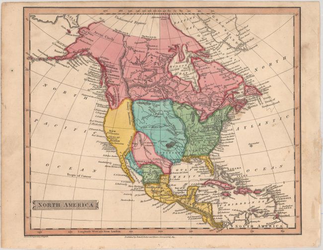
Subject: North America
Period: 1814 (dated)
Publication:
Color: Hand Color
Size:
8.8 x 7.3 inches
22.4 x 18.5 cm
This attractive map of North America shows the United States confined to east of the Mississippi River despite its 1814 date. Louisiana stretches from the Mississippi River west to the Rocky Mountains, and Spain is in control of the western United States. Alaska is taking shape with some islands shown at the end of the Aleutian Peninsula. Notes related to the exploration of MacKenzie and Hearne are shown in northern Canada just south of "Undiscovered Regions." Published by Nuttall, Fisher and Dixon in Liverpool.
References:
Condition: B+
Issued folding with a minor ink stain at center and light soiling mostly in the margins.