Subject: Western Hemisphere - America
Period: 1824 (dated)
Publication:
Color: Hand Color
Size:
19.4 x 22.8 inches
49.3 x 57.9 cm
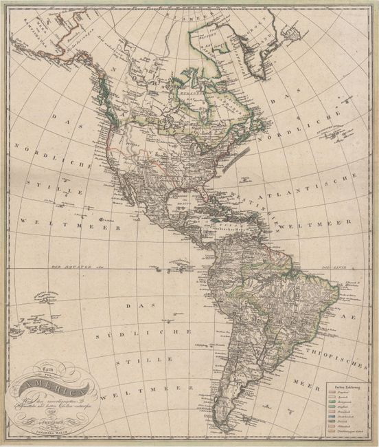
An attractive map of the Americas extending from the Aleutian Islands to Tierra del Fuego. The United States is shown extending to the Pacific Ocean with only a few names in the West including a large Quivira and New Albion along the coast. Mexico is in control of the Southwest including Texas, which is named as a city. Numerous Indian tribes are named in the middle of the United States with a dotted line extending the Missouri River to the northwest. There is no delineation of the Columbia River, though a "Columbia Thal" is named. In the Pacific, the Hawaiian Islands do not appear, though there is an erroneous group of islands with Spanish names. These islands were introduced on maps in the mid-18th century and were not corrected until the early 19th century. In the Atlantic Ocean, the Gulf Stream is prominently depicted. The South American continent is very well mapped and filled with detail, although the mythical lakes of Parime and Xarayes still appear. The map is color-coded to show the colonial possessions of 9 countries, and the map is adorned by a cartouche with fancy titling.
References:
Condition: B+
Narrow, but adequate, margins all around with some minor foxing and a tiny edge tear at left that just passes the border.