Subject: Southeast Australia
Period: 1833-58 (circa)
Publication:
Color: Hand Color
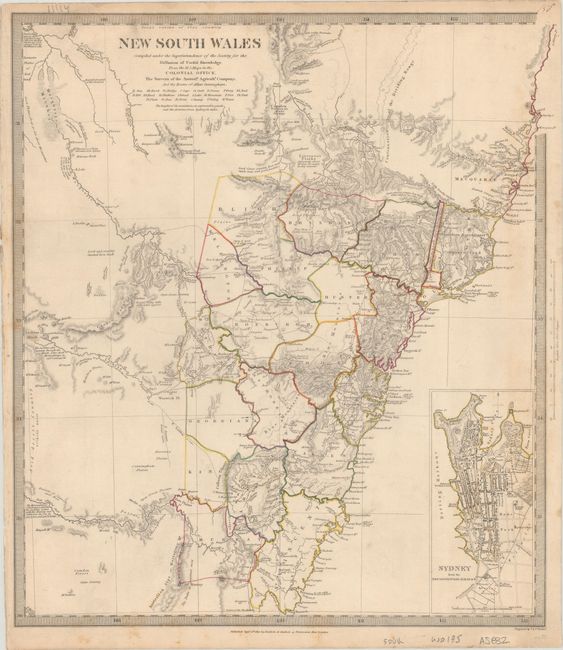
A. New South Wales, by SDUK Society for the Diffusion of Useful Knowledge, dated 1833 (13.6 x 15.2"). An incredibly detailed map of the thriving colony compiled "From the M.S. maps in the Colonial Office, the Surveys of the Australian Agricultural Company, and the Routes of Allan Cunningham." The counties are colored in outline and the eastern part of the map is detailed with topographical features and interesting notations. A large inset plan of Sydney from the New South Wales Almanack marks important buildings including bathing houses, a botanic garden, and the Albion Brewery, established in 1827. Published by Baldwin & Cradock. Condition: Contemporary outline color on a sheet with some light scattered foxing and minor soiling.
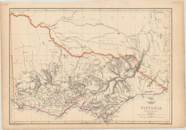
B. Victoria (Australia), by Edward Weller, from Weekly Dispatch Atlas, circa 1858 (16.7 x 12.1"). This handsome and informative map of Victoria appeared in the Weekly Dispatch Atlas, which was published in monthly segments for subscribers of the Weekly Dispatch newspaper. The monthly editions eventually grew to include maps covering most of the known world. The map features intricate topographical detail with notes on the terrain such as "Barren Sand Hills & Mallee Scrub" and "Flat scrubby Country." It extends into New South Wales, where detail is mostly limited to the network of rivers. The Dispatch Atlas seal appears above the title. Condition: Contemporary outline color with minor scattered foxing, marginal toning, and an edge tear in the bottom blank margin.
References: Tooley (Australia) #1155 & cf. #1329.
Condition: B+
See description above.