Subject: Central Africa
Period: 1683 (published)
Publication: Geographise en Historise Werelt Beschryving
Color: Hand Color
Size:
10.5 x 7.9 inches
26.7 x 20.1 cm
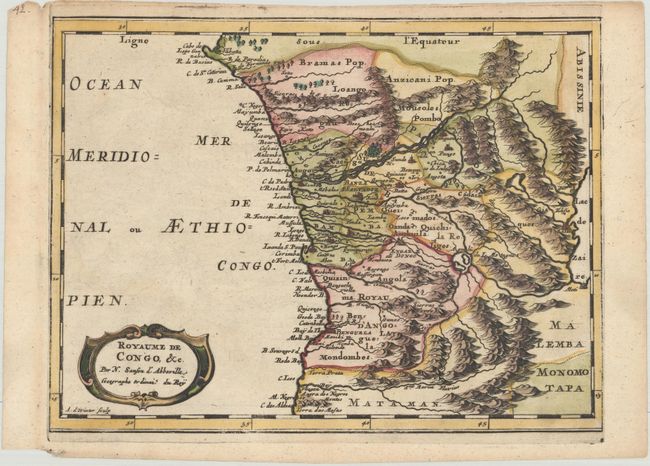
Attractive map of Gabon, the Congo and Angola from Cape Lopez and Sao Tomé to approximately the border with present-day Namibia. The map is fully engraved with mountains, rivers, forests and trails and decorated with a strapwork title cartouche. Engraved by Antoine de Winter.
Sanson's small maps from his L'Afrique en Plusieurs Cartes..., first published in 1656 and engraved by A. Peyrounin, were copied several times by various map publishers. Johann David Zunners made copies of Sanson's maps for his German translation of Die Gantze Erd-Kugel in 1679. Johannes Ribbius and Simon de Vries published copies in 1682 and 1683, with new maps engraved by Antoine d'Winter. The plates were later sold to Francois Halma, who used them in 1699 and then again in 1705 with the titles re-engraved in Dutch. The titles on the d'Winter plates were re-engraved back into French, and then used by Nicholas Chemereau in 1715 and by Henri du Sauzet in 1738.
References: Pastoureau, SANSON I F bis.
Condition: A
A dark impression with marginal soiling and a small worm hole in the right blank margin.