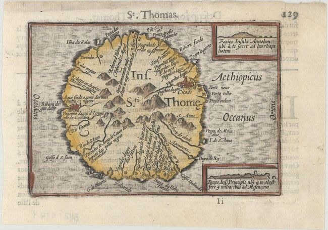
Subject: Sao Tome Island
Period: 1600 (published)
Publication: Thresor de Chartes
Color: Hand Color
Size:
4.9 x 3.4 inches
12.4 x 8.6 cm
This tiny map details Sao Tome Island, an important Portuguese colony off the African coast that played a role in the African slave trade. Two small insets show coastal profiles. French text on verso.
The map was first published by Cornelius Claesz and printed by Barent Langenes in the 1598 edition of the popular Map Treasury. For the 1599 edition, graduation lines and latitude numerals were added to one side of the border on most of the maps, which were again used for multiple editions through 1650. This is from a French edition, printed by Albert Hendricks.
References: King (2nd ed.) pp. 80-82; Van der Krogt (Vol. III) #8950:341.
Condition: A
A nice impression on a bright sheet with a faint damp stain at top right and a few tiny, archivally repaired tears along the edges of the sheet.