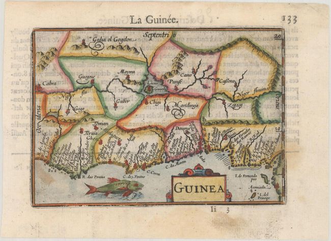
Subject: Western Africa
Period: 1600 (published)
Publication: Thresor de Chartes
Color: Hand Color
Size:
4.8 x 3.4 inches
12.2 x 8.6 cm
A beautiful miniature map of the west coast of Africa covering the coast from Liberia to Cameroon. The majority of the place names are confined along the coast, while the interior is largely blank except for the Niger River and a large lake. Though not signed, this map was likely engraved by Petrus Kaerius, who engraved the majority of the maps of the Caert-thresoor (Map Treasury). French text on verso.
The map was first published by Cornelius Claesz and printed by Barent Langenes in the 1598 edition of the popular Map-treasury. For the 1599 edition, graduation lines and latitude numerals were added to one side of the border on most of the maps, which were again used for multiple editions through 1650. This is the second state with the added graduation lines from a French edition, printed by Albert Hendricks.
References: King (2nd ed.) pp. 80-82; Van der Krogt (Vol. III) #8700:341.
Condition: A
A dark impression on a bright sheet with a few faint stains.