Subject: Eastern Africa & Arabia
Period: 1760 (circa)
Publication:
Color: Black & White
Size:
16.9 x 13.1 inches
42.9 x 33.3 cm
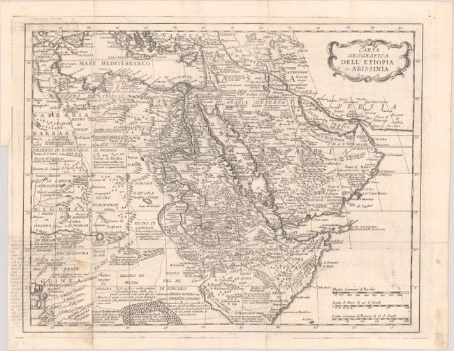
This map encompasses northeastern Africa and southwestern half of the Middle East and is filled with place names, tribes, notations and charming depictions of mountains, forests and tented villages. This map provides a look at the geographical knowledge prevalent in the mid-eighteenth century. The source of the Nile is L. di Dambee, and the Niger originates in Lago di Bournou, possibly a reference to today’s Lake Chad. The map appeared in an Italian edition of Thomas Salmon's multi-volume Modern History, which was published in up to 31 volumes starting in 1724, with several editions in English, Dutch, German and Italian through 1782.
References:
Condition: B+
Issued folding on sturdy paper with light offsetting from an opposing page of text in the panels at top left and bottom left. There is some minor soiling and printer's ink residue.