Subject: Northwestern Africa
Period: 1585-1628 (circa)
Publication:
Color: Black & White
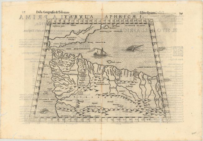
A. Tabula Aphricae I, by Girolamo Ruscelli, published 1598 (10.0 x 6.9"). Ptolemaic map of northwestern Africa that extends to include the Strait of Gibraltar and southern Spain. The interior is filled with mountains, rivers and settlements. This fourth edition is further illustrated by two sea monsters and a ship in the Mediterranean. Reference: Mickwitz & Miekkavaara #227-11. Condition: A strong impression on a bright sheet with numerous worm tracks mostly along the centerfold with some minor loss of image. (B)
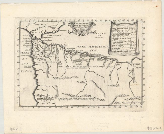
B. Mauritaniae Duae Bogudiana et Bochiana ex Plinio, by Melchior Tavernier, dated 1628, (7.4 x 5.1"). This map illustrates the ancient geography of the region including Morocco and Algeria and bounded by the Atlas Mountains to the south. A table at top shows the distances between locations in Roman miles. Condition: A dark impression on a clean sheet. (A)
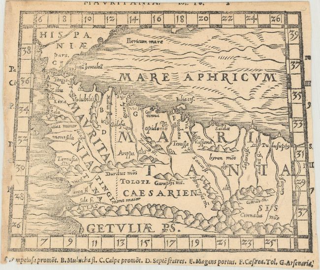
C. Mauritania, by Pomponius Mela, from Pomponii Melae de Orbis Situ Libri III..., published 1595 (6.1 x 4.8"). An uncommon miniature woodblock map of northwestern Africa that was published in Mela's Pomponii Melae de Orbis Situ Libri III... Includes numerous rivers, mountains, and a key at bottom. Reference: Shirley (BL Atlases) G.MELA-1c #2. Condition: Trimmed close on all sides with a portion of the title above the map missing. (B+)
References:
Condition:
See description above.