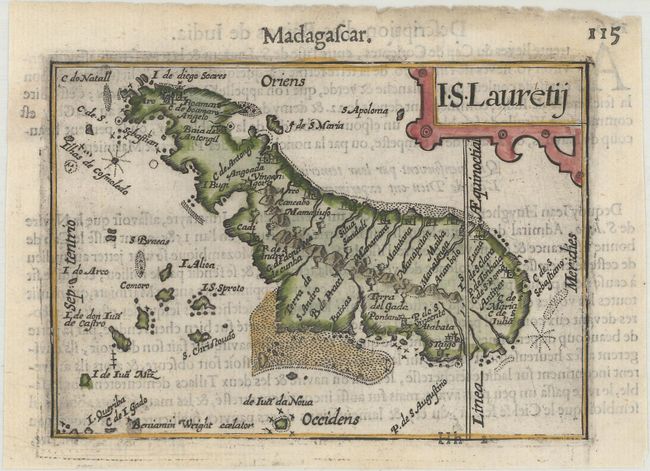
Subject: Madagascar
Period: 1600 (published)
Publication: Thresor de Chartes
Color: Hand Color
Size:
4.9 x 3.4 inches
12.4 x 8.6 cm
Charming miniature map of Madagascar that the Portuguese named St. Laurence. North is oriented to the left and the Tropic of Capricorn cuts across the southern tip of the island. French text on verso.
The map was first published by Cornelius Claesz and printed by Barent Langenes in the 1598 edition of the popular Map Treasury. For the 1599 edition, graduation lines and latitude numerals were added to one side of the border on most of the maps, which were again used for multiple editions through 1650. This is from a French edition, printed by Albert Hendricks.
References: King (2nd ed.) pp. 80-82; Van der Krogt (Vol. III) #8900:341B.
Condition: A
A dark impression on a bright sheet with some show-through of text on verso and an archivally repaired tear in the left blank margin.