Subject: Southern Asia
Period: 1778 (circa)
Publication:
Color: Hand Color
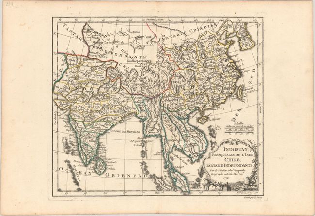
A. Indostan, Presqu'isles de l'Inde, Chine, Tartarie Independante, by Robert de Vaugondy, from Nouvel Atlas Portatif, dated 1778 (11.1 x 9.4"). Nicely engraved copperplate map of India, Southern China and part of Southeast Asia. The map extends from the eastern border with Persia and includes Coree and Formosa. There is good detail of political boundaries, rivers and mountain ranges. Embellished with a fine cartouche engraved by Arrivet. This is the second state, dated 1778 and published by Fortin. Engraved by E. Dussy. Reference: Pedley #398. Condition: A nice impression with minor color offsetting and some faint soiling. (A)
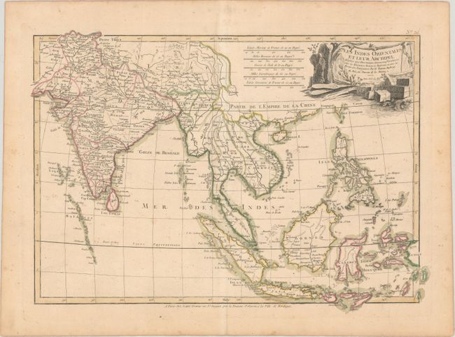
B. Les Indes Orientales et Leur Archipel Assujeties aux Observations Astronomiqes Combinees..., by Bonne/Lattre, (18.2 x 12.8"). A beautifully engraved map of the area from India to the Philippines including the islands of the East Indies, the Maldives and part of Taiwan. At the tip of the Malaysian Peninsula is a group of islands including Sin Capura. Political subdivisions and place names are shown in considerable detail. The decorative title cartouche features a sailing ship and cargo representing the importance of the region. Condition: On a lightly toned sheet with a large watermark of a Maltese cross encircled in rosary beads. There is light scattered foxing. (B+)
References:
Condition:
See description above.