Subject: China, Korea & Japan
Period: 1630 (published)
Publication: Atlas Minor
Color: Hand Color
Size:
7.6 x 5.3 inches
19.3 x 13.5 cm
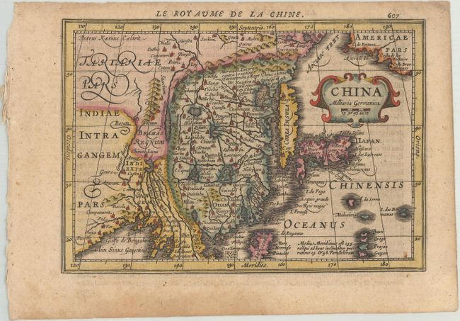
This handsome map of the region is based on the folio map by Jodocus Hondius and was designed for the Atlas Minor, first published in 1628. The eastern part of China (bounded in the west by the Great Wall) is dominated by several large lakes and major rivers. Korea is depicted as a strangely shaped island. The three main islands of Japan are shown below the strapwork cartouche. Americae Pars appears in the upper right corner separated from Asia by a narrow Anian Strait. Engraved by Petrus Kaerius. French text on verso.
This map was re-engraved for Jan Jansson's editions of the Atlas Minor, published in 5 editions between 1628-48. The copperplates for the original Atlas Minor editions published by Hondius were sold to parties in England between 1621-25. Jansson commissioned Pieter van den Keere and Abraham Goos to engrave new plates, which were close copies of the original editions.
References: Van der Krogt (Vol. III) #8410:352.1.
Condition: B+
A nice impression with very light toning and a damp stain confined to the bottom blank margin.