Subject: Northern Asia
Period: 1716 (circa)
Publication: Neuer Atlas uber die Gantze Welt
Color: Hand Color
Size:
22.4 x 19.1 inches
56.9 x 48.5 cm
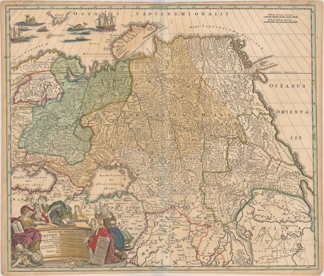
This large map shows the whole of Russia from the Black Sea and the Baltic to Kamchatka, and includes China and Northern India. Just above the Arctic Circle is a partially delineated island or peninsula labeled incognita. Beautifully engraved and highly detailed, the map shows forests, watershed, roads, and many tiny villages. The Great Wall of China is prominently depicted along with a desert extending though western China. Although unnamed, the Chimay Lacus appears with four rivers flowing south. A very elaborate cartouche embellishes the lower corner with historical figures, a ship, globes and putti. The sea at upper left is filled with two sailing ships and several rowboats with men harpooning sea monsters.
References:
Condition: B+
Contemporary color in the map with later color in the decorative elements. There is very light toning and soiling and narrow margins at top and bottom, as issued.