Subject: Northern Asia
Period: 1647 (published)
Publication: Atlas Novus
Color: Hand Color
Size:
19.6 x 15 inches
49.8 x 38.1 cm
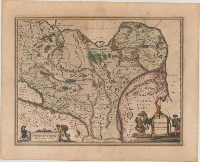
This great map of Tartaria covers all of eastern Asia between the Caspian Sea and northern China and Manchuria. Being one of the most remote regions of Asia, it was among the last to be properly explored and mapped. This map combines the knowledge obtained by the English and Dutch explorers as far as the Ob River with the balance of the map based on the reports of Marco Polo and the Greek classics. The deserts are filled with a wild assortment of devils and dragons, being held at bay from China by the Great Wall. Explorers flank the distance scale and the title is symbolically engraved onto the saddle blanket of a camel, representing the trade over the Silk Road. This map is nearly identical to Blaeu's map of the same title, but does not have a scale across the top. Latin text on verso.
References: Van der Krogt (Vol. I) #8050:1B.
Condition: B
Full contemporary color that has been partially refreshed with light soiling and offsetting. There is one short crack in the image at bottom right that has been archivally repaired on verso. This map will ship flat - international customers please contact us for a shipping quote.