Catalog Archive
Auction 178, Lot 463

NO RESERVE

"Carte de la Tartarie Independante qui Comprend le Pays des Calmuks, Celui des Usbeks, et le Turkestan, avec Leurs Dependances...", Bonne/Lattre

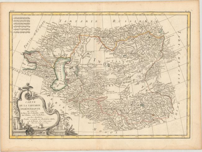
Subject: Central Asia

Period: 1787 (circa)

Publication: Atlas Moderne

Color: Hand Color

Size:
17.4 x 12.1 inches
44.2 x 30.7 cm
Download High Resolution Image
(or just click on image to launch the Zoom viewer)

This beautifully engraved map centers on Uzbekistan and stretches from the western banks of the Black Sea east to Tibet. It includes the Caucasus, the Caspian Sea, the Aral Sea, and the Gobi Desert. It captures the topography of the region in nice detail and identifies hundreds of place names. In the top left corner, there are six distance scales. An ornate title cartouche dominates the bottom right corner of the composition.

References:

Condition: B+

A nice impression with contemporary color on a watermarked sheet. There is a small paper flaw in the image at bottom right, minor toning along the centerfold, and light damp stains along the bottom edge of the sheet.

Estimate: $100 - $130

Sold for: $55

Closed on 6/10/2020

Archived