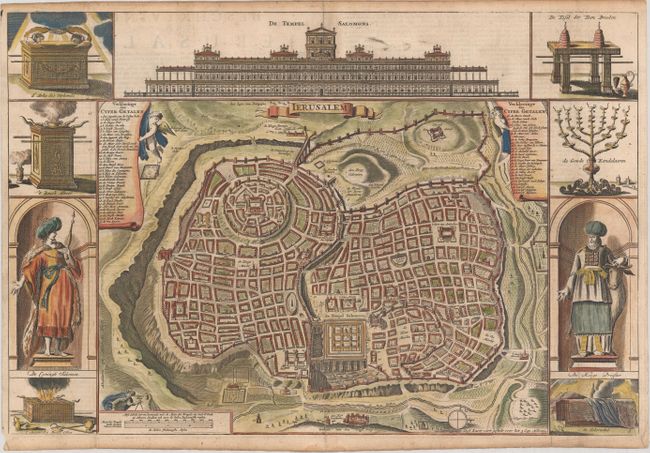
Subject: Jerusalem, Holy Land
Period: 1710 (circa)
Publication:
Color: Hand Color
Size:
17.9 x 12 inches
45.5 x 30.5 cm
Beautiful and fully engraved bird's-eye plan of the holy city flanked by engravings of religious icons, Solomon and a high priest. Reportedly after Vallapando's imaginary city plan, the map was published in a Dutch Bible. At the top is a large and ornate elevation of the Temple of Solomon. Dutch text on verso. Published by Jacob and Pieter Keur.
References: Poortman & Augusteijn #142-KII-2.
Condition: B+
A nice impression, issued folding, with light soiling that is mostly confined to the blank margins, and professionally repaired centerfold separations at top and bottom.