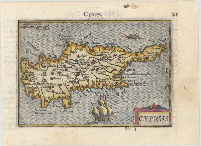
Subject: Cyprus
Period: 1600 (published)
Publication: Thresor de Chartes
Color: Hand Color
Size:
4.8 x 3.4 inches
12.2 x 8.6 cm
Miniature map of Cyprus with a good amount of detail for its size. The sea is engraved in a moiré pattern and a large ship sails to the south of the island. Though not signed, this map was likely engraved by Petrus Kaerius, who engraved the majority of the maps of the Map Treasury. French text on verso.
The map was first published by Cornelius Claesz and printed by Barent Langenes in the 1598 edition of the popular Map Treasury. For the 1599 edition, graduation lines and latitude numerals were added to one side of the border on most of the maps, which were again used for multiple editions through 1650. This is from a French edition, printed by Albert Hendricks.
References: King (2nd ed.) pp. 80-82; Van der Krogt (Vol. III) #8130:341.
Condition: A
A dark impression on a bright sheet with a faint stain in the right blank margin.