Catalog Archive
Auction 178, Lot 376

"Estats de Pologne Subdivises Suivant Lestendue des Palatinats", Schenk, Pierre

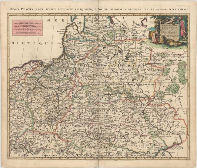
Subject: Eastern Europe, Poland

Period: 1740 (circa)

Publication:

Color: Hand Color

Size:
22.6 x 18.2 inches
57.4 x 46.2 cm
Download High Resolution Image
(or just click on image to launch the Zoom viewer)

A scarce map of Poland, Lithuania, Latvia, Belarus and Ukraine based on Sanson's cartography. The map encompasses the region between the Baltic Sea and the Black Sea. A figurative cartouche fills the upper corner featuring a merchant and cherubs with a beehive and bear skins. Titled in top margin: Regni Poloniae Magni Ducatus Lithuaniae Reliquarumque Polonis Subditarum Regionum Tabula.

References:

Condition: B+

A dark impression with full contemporary color, very light soiling, and a centerfold separation that enters 1" into image at bottom and has been closed with archival tape on verso.

Estimate: $475 - $600

Sold for: $550

Closed on 6/10/2020

Archived