Subject: Portugal
Period: 1600 (published)
Publication: Thresor de Chartes
Color: Hand Color
Size:
4.8 x 3.3 inches
12.2 x 8.4 cm
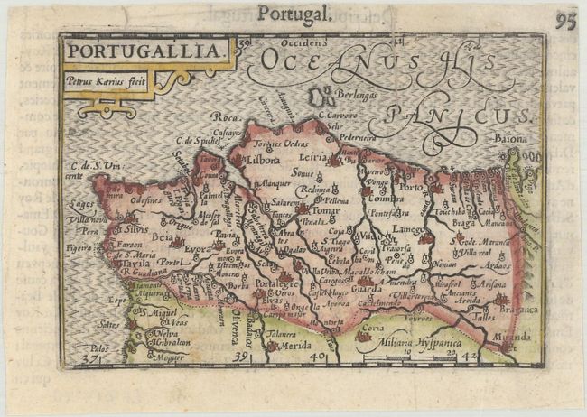
A handsome miniature map of Portugal, with north oriented to the right. There is good detail of the towns and rivers in the region. Adorned with a strapwork cartouche and engraved by Pieter van den Keere. French text on verso.
The map was first published by Cornelius Claesz and printed by Barent Langenes in the 1598 edition of the popular Map Treasury. For the 1599 edition, graduation lines and latitude numerals were added to one side of the border on most of the maps, which were again used for multiple editions through 1650. This is from a French edition, printed by Albert Hendricks.
References: King (2nd ed.) pp. 80-82; Van der Krogt (Vol. III) #6300:341.
Condition: B+
A nice impression on a bright sheet with very minor soiling and two archivally repaired tears at top, one of which enters 1" into the image.