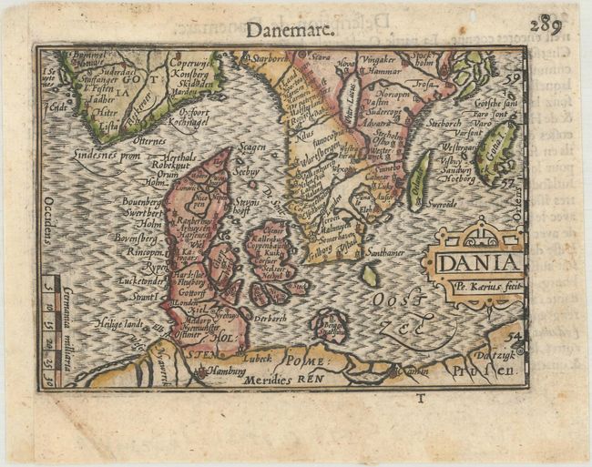
Subject: Denmark
Period: 1600 (published)
Publication: Thresor de Chartes
Color: Hand Color
Size:
4.9 x 3.4 inches
12.4 x 8.6 cm
This miniature map of Denmark extends to include southern Sweden and parts of northern Germany. Tiny towns, river, and islands are shown. Engraved by Pieter van den Keere. French text on verso.
The map was first published by Cornelius Claesz and printed by Barent Langenes in the 1598 edition of the popular Map Treasury. For the 1599 edition, graduation lines and latitude numerals were added to one side of the border on most of the maps, which were again used for multiple editions through 1650. This is from a French edition, printed by Albert Hendricks.
References: King (2nd ed.) pp. 80-82; Van der Krogt (Vol. III) #1500:341.
Condition: A
A dark impression with a small worm hole in the top blank margin and professionally remargined at left with period-correct paper.