Subject: Baltic, Estonia & Latvia
Period: 1600 (published)
Publication: Thresor de Chartes
Color: Hand Color
Size:
4.9 x 3.4 inches
12.4 x 8.6 cm
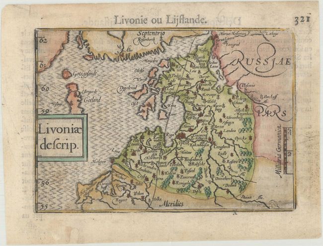
This delightful little map of Estonia and Latvia is filled with a good amount of detail for its size. French text on verso.
The map was first published by Cornelius Claesz and printed by Barent Langenes in the 1598 edition of the popular Map Treasury. For the 1599 edition, graduation lines and latitude numerals were added to one side of the border on most of the maps, which were again used for multiple editions through 1650. This is from a French edition, printed by Albert Hendricks.
References: King (2nd ed.) pp. 80-82; Van der Krogt (Vol. III) #1710:341.
Condition: B+
Light soiling with a vertical pen mark and professional repairs to a tiny chip and tear along the edges of the sheet.