Subject: Ireland
Period: 1619 (published)
Publication: Gerardi Mercatoris - Atlas sive Cosmographicae…
Color: Hand Color
Size:
18.5 x 13.4 inches
47 x 34 cm
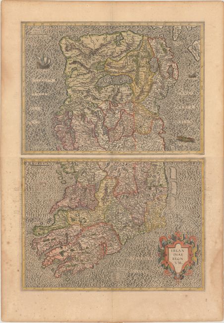
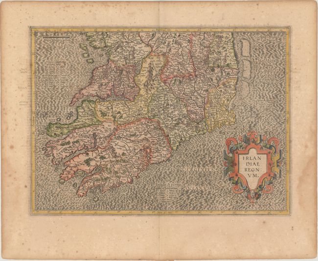
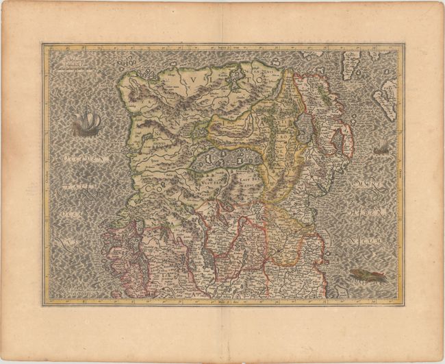
Superb early pair of maps covering the whole of Ireland compiled from his landmark map of Britain (1564). These two maps were among five Irish maps Mercator designed for the second part of his Atlas. The maps are richly engraved with a moiré pattern in the seas and strong topographical features in the interior. The northern section is decorated with sailing ships and a sea monster and there is no title cartouche - only Mercator's imprint. The southern sheet features the bold, strapwork title cartouche. Size is for each map. French text on verso.
References: Law, pp. 19-20; Van der Krogt (Vol. I) #5901:1.1 & #5902:1.1.
Condition:
Nice impressions on watermarked paper with light toning and marginal damp stains. The northern sheet is in very good condition (B+), and the southern sheet is in good condition (B) due to scattered foxing. The first image is a composite image - the map is in two separate sheets.