Subject: Saint Helena Island
Period: 1600 (published)
Publication: Thresor de Chartes
Color: Hand Color
Size:
4.8 x 3.5 inches
12.2 x 8.9 cm
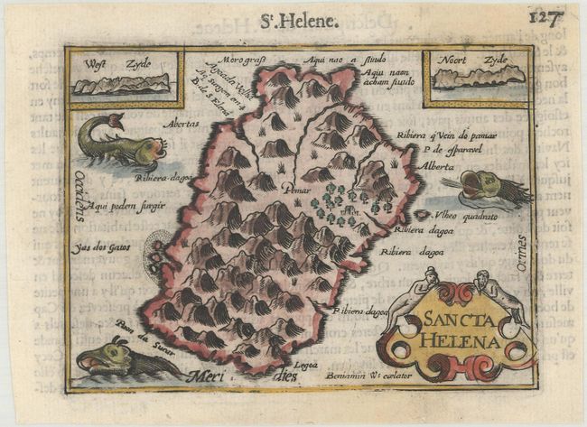
The map of Saint Helena shows an important stopover for ships trading between Europe and Africa or Asia. Two coastal approach views show the west and north side of the island. Three sea monsters and a decorative cartouche embellish the tiny map. Engraved by Benjamin Wright. French text on verso.
The map was first published by Cornelius Claesz and printed by Barent Langenes in the 1598 edition of the popular Map Treasury. For the 1599 edition, graduation lines and latitude numerals were added to one side of the border on most of the maps, which were again used for multiple editions through 1650. This is from a French edition, printed by Albert Hendricks.
References: King (2nd ed.) pp. 80-82; Van der Krogt (Vol. III) #8960:341B.
Condition: B+
A dark impression on a bright sheet with faint stains at top and bottom.