Subject: Southern South America
Period: 1630 (circa)
Publication: Nieuwe Wereldt ofte Beschrijvinghe van West-Indien…
Color: Black & White
Size:
14.1 x 11.1 inches
35.8 x 28.2 cm
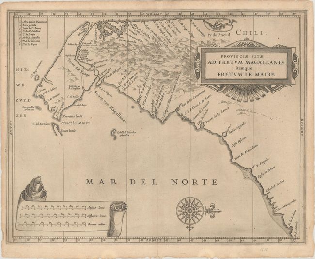
This fine map is the work of Hessel Gerritsz, one of the most important Dutch cartographers of the 17th century. His cartography of South America laid the foundation for many other cartographers. The map vividly depicts the important tip of South America, key to European trade with the East Indies, with the narrow and treacherous Strait of Magellan and the recently discovered Strait le Maire. The map is oriented with north on the right and it is simply embellished with a strapwork title cartouche, compass rose, and banner containing three distance scales.
References: Shirley (BL Atlases) G.LAET-1b #10.
Condition: A
A dark impression with a hint of toning and a few tiny spots. There are some tiny tears and chips along the edges of the sheet.