Catalog Archive
Auction 178, Lot 255

"[Lot of 3] Carte du Bresil Prem. Partie Depuis la Riviere des Amazones… [with] Suite du Bresil... [and] Suite du Bresil, Depuis la Baie de Tous les Saints Jusqu'a St. Paul…", Bellin, Jacques Nicolas
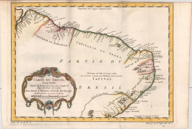
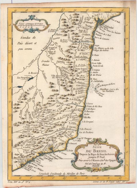
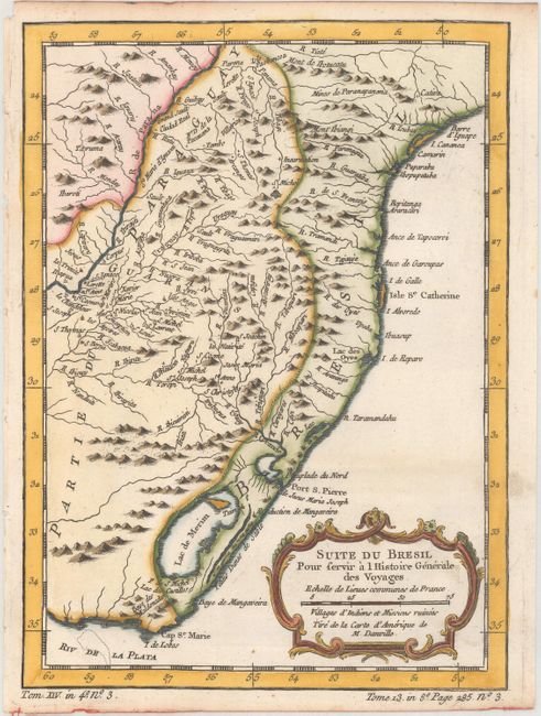
Subject: Brazil

Period: 1780 (circa)

Publication: La Harpe's Histoire Generale des Voyages

Color: Hand Color

Size:
12.8 x 9.4 inches
32.5 x 23.9 cm
Download High Resolution Image
(or just click on image to launch the Zoom viewer)

These three matched maps cover the entire Brazilian coastline and show the capitaincies or hereditary harbor offices. The first map, Carte du Bresil Prem. Partie Depuis la Riviere des Amazones…, (12.6 x 9.3"), covers from the mouth of the Amazon to Baía de Todos os Santos. Only coastal detail is shown with the interior region noted as being unknown and the domain of the Tapuyas Indian nation. The second, Suite du Bresil... (6.7 x 9.2"), covers from Salvador to Santos, and the third, Suite du Bresil, Depuis la Baie de Tous les Saints Jusqu'a St. Paul… (6.5 x 9.2"), continues to Maldonado in Uruguay. Both of these maps have more interior detail.

References:

Condition: A

Crisp impressions on bright sheets with light rippling of the paper and minor marginal soiling. The first map is issued folding and has minor offsetting.

Estimate: $200 - $230

Unsold

Closed on 6/10/2020

Archived