Subject: North Pole
Period: 1779 (dated)
Publication: Atlante Novissimo…
Color: Hand Color
Size:
16.3 x 12.6 inches
41.4 x 32 cm
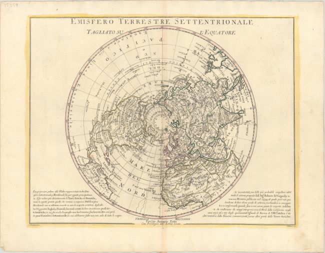
Based on Robert de Vaugondy's map, this polar projection covers from the North Pole to the equator. In North America, the mythical Northwest Passage is shown connecting through the Strait of Anian and L. de Fonte to Hudson Bay. The map also includes Lahontan’s system of rivers and lakes in the west; it labels the river connecting the Mississippi River to the Pacific the F. Bella Riviera (Beautiful River). The Arctic discoveries of the eighteenth century are all well depicted. Engraved by Zuliani with lettering by Pitteri.
References: Shirley (BL Atlases) T.ZAT-1a #9.
Condition: A
Contemporary outline color on watermarked paper with minor toning along the centerfold and two faint dampstains that just cross the neatline at left and right.