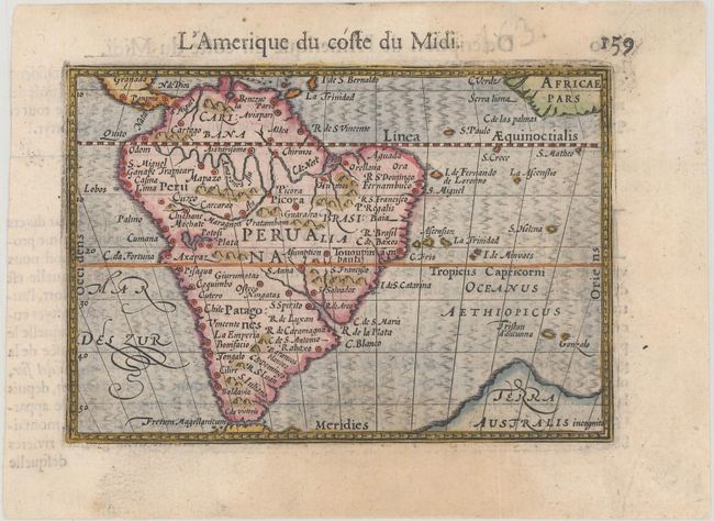
Subject: South America
Period: 1600 (published)
Publication: Thresor de Chartes
Color: Hand Color
Size:
4.8 x 3.3 inches
12.2 x 8.4 cm
This interesting little map shows South America as derived from Diego Gutiérrez' s Americae sive quartae orbis partis nova et exactissima descriptio... of 1562. It is a well-detailed map, with a fairly accurate Amazon and La Plata, but the River Maranon is largely out of proportion, and enters the Amazon too far east. The Great Southern Continent, Terra Australis incognita, extends into the south Atlantic Ocean. French text on verso.
The map was first published by Cornelius Claesz and printed by Barent Langenes in the 1598 edition of the popular Map-treasury. For the 1599 edition, graduation lines and latitude numerals were added to one side of the border on most of the maps, which were again used for multiple editions through 1650. This is the second state with the added graduation lines from a French edition, printed by Albert Hendricks.
References: King (2nd ed.) pp. 80-82; Van der Krogt (Vol. III) #9800:341.
Condition: A
A nice impression with a faint damp stain at bottom.