Subject: Mexico & Central America
Period: 1671 (circa)
Publication: De Nieuwe en Onbekende Weereld
Color: Hand Color
Size:
14.3 x 11.3 inches
36.3 x 28.7 cm
Montanus' work was perhaps the greatest illustrated book on the New World produced in the seventeenth century. It contained over one hundred beautifully engraved plates, views, and maps of North and South America. The plates vividly depict forts, festivals, occupations, Dutch fleets, battles, religious rites, and customs of the native inhabitants. This important work was translated into German by Olivier Dapper, and into English by John Ogilby. Several of the plates were later acquired by Pierre Vander Aa.
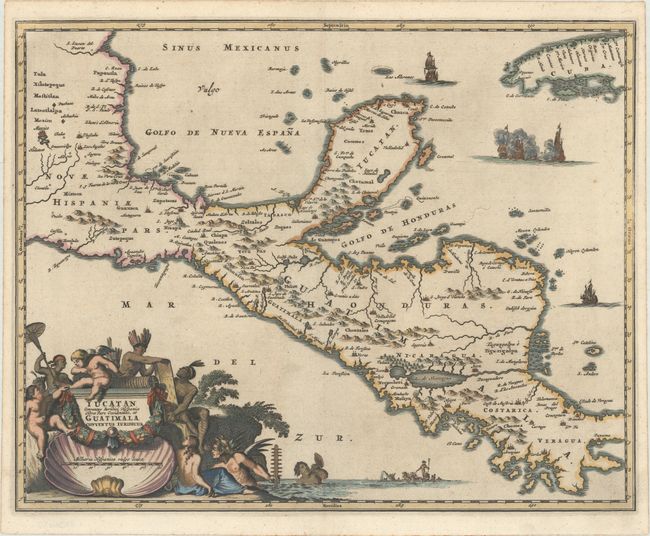
This decorative map covers the region from Mexico City to Panama City and extends to include part of Cuba, and is based on Blaeu's map of the Yucatan peninsula. Cozumel is named, and Lake Nicaragua is presented on an east-west orientation. This map is richly adorned with ships engaged in battle, Neptune and his entourage, and an elaborate title cartouche with Natives, putti, and a large shell.
References:
Condition: A
A dark impression on a sheet with a jester watermark, a hint of toning, and minor creasing along the top edge of the sheet.