Subject: World, Oil
Period: 1958 (dated)
Publication:
Color: Printed Color
Size:
45.1 x 36.3 inches
114.6 x 92.2 cm
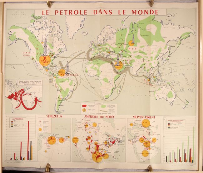
This wall-sized map depicts the global oil and gas industry, with particular focus on the key producing regions in Venezuela, the United States, and the Middle East. The yellow circles show the key regions that produce oil, with the size of the oil rig towers representing the amount of crude oil produced. The red areas are the operating oil fields while the green regions are sedimentary lands that are likely to contain petroleum. The gray arrows show the primary exportation routes throughout the world for petroleum products. A number of inset maps contain further interesting detail, such as a map showing the change in petroleum distribution as a result of the Suez Crisis in 1956, and maps of Venezuela, the United States, and the Middle East locating current pipelines, pipeline projects, and refineries. The two graphs show the change in oil production between 1900-56 in the key regions, as well as the evolution of the primary sources of energy (coal, oil, natural gas, and hydraulic power) worldwide during the same time period. Printed by Imp. Lafayette and published by the Union des Chambres Syndicales de l'Industrie du Petrole in Paris.
References:
Condition: A
A clean and bright example, issued folding, with a short tear at bottom left that enters less than 1" into the inset of Venezuela and has been partially closed on verso with archival materials.