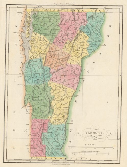
Subject: Vermont
Period: 1825 (published)
Publication: Atlas Geographique, Statistique, Historique ... des Deux Ameriques
Color: Hand Color
Size:
8.9 x 12 inches
22.6 x 30.5 cm
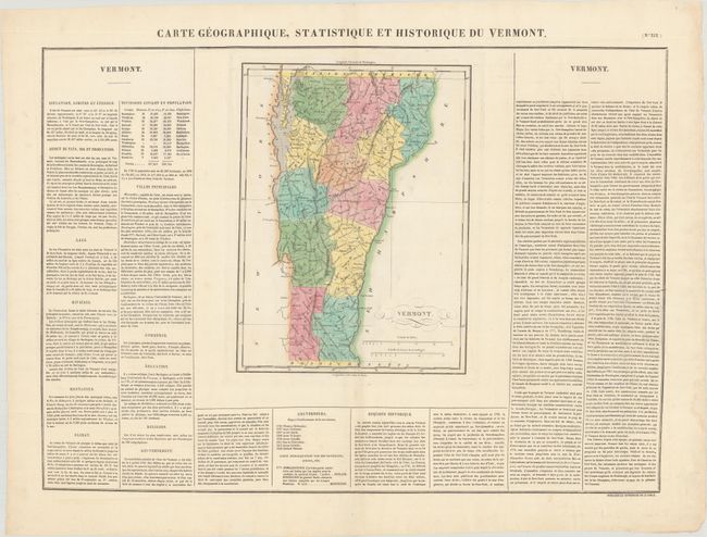
This is the French edition of Carey & Lea's map of the Green Mountain State. It delineates thirteen counties and highlights the two principle battle sites of Hubbardstown and Bennington with small flags. The map was originally engraved by Young & Delleker in 1822. On a full folio sheet (27.0 x 20.6") with French text flanking the map that describes the state's rivers, lakes, mountains, climate, history, and more. Buchon produced the French edition of Carey & Lea's American Atlas. He used a better quality paper and today his maps are generally found in better condition than their American counterparts.
References: Phillips (Atlases) #1176-19.
Condition: A
Contemporary color on a bright sheet with a few faint spots of foxing, most of it outside the map image, and a small hole in the bottom left margin.