Subject: San Antonio, Texas
Period: 1935 (circa)
Publication:
Color: Printed Color
Size:
32.8 x 41.9 inches
83.3 x 106.4 cm
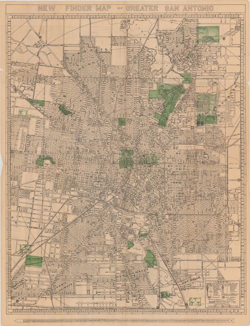
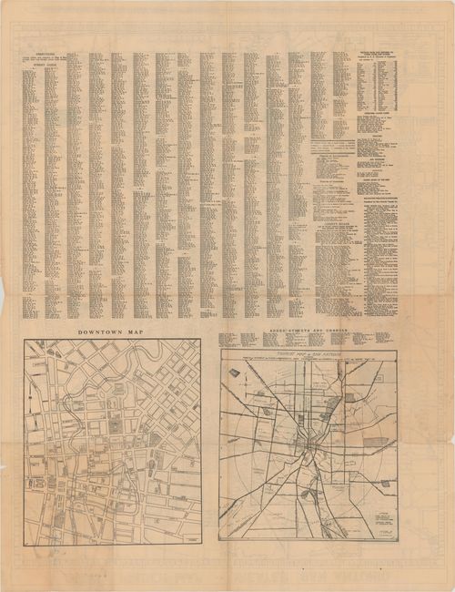
A large detailed street map of the San Antonio region with concentric circles radiating out from downtown at one mile intervals. A legend at lower right identifies various schools, parks and cemeteries, while additional points of interest are highlighted in green overprnting on the map (The Alamo, Fort Sam Houston, San Jose Mission, and more). The verso contains a detailed street index and two smaller maps: Tourist Map of San Antonio (14 x 13.5") and Downtown Map (15.3 x 13.0"). Drawn by L.M. Stitzell and published by Southwell Map Company. There are no past sales records of this map and only one institutional example found on OCLC.
References:
Condition: B+
Issued folding with several small splits at the fold junctions with minute loss of image at one junction. There are a few minor edge tears and chips confined to the blank margins.