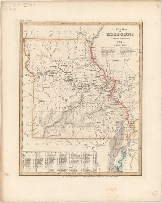
Subject: Missouri
Period: 1845 (dated)
Publication: Meyer's Hand-Atlas
Color: Hand Color
Size:
11.8 x 14.6 inches
30 x 37.1 cm
This is the German edition of the Tanner/Mitchell map of Missouri from the New Universal Atlas, with a German title but English place names. The map is filled with detail of counties, cities, roads, and towns. County configuration is unusual and hard to date; for instance, the southwest corner is dominated only by Greene and Pulaski counties, with Greene county to the north. The Platte Purchase of 1836 is reflected in the northwestern corner of the state. A table in the lower portion of the map shows the steamboat routes from St. Louis to Shawnee, Prairie du Chien and the mouth of the Kansas River. Published by the Hildburghausen Biblio Institut.
References:
Condition: A
A nice impression with a few minor spots confined to the blank margins.