Subject: Western Massachusetts
Period: 1896 (dated)
Publication:
Color: Printed Color
Size:
22 x 29.8 inches
55.9 x 75.7 cm
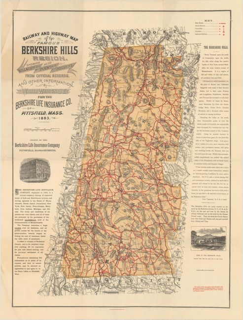
This noteworthy map was published by Walter Watson for the Berkshire Life Insurance Company, Pittsfield, Mass. The map lays out the railways and highways of the Berkshire Hills region in remarkable detail. A legend identifies main roads, school houses, cemeteries, churches and railroad stations. The Berkshire Hills are described at right in a long excerpt from "Taghconic," by J.E.A. Smith. Red type in lower right notes the map is available by contacting the company or any of its agents in the principle cities. A vignette shows the company's headquarters building and another "View of the Berkshire Hills. Greylock Peak from the south end of Lake Onota." According to the Harvard University Gazette, Oct. 24, 2002, this map is widely regarded as the first 'free' road map ever distributed mainly for use by touring bicyclists when it was first published in 1883. This example is the 1896 revised edition.
References:
Condition: A
Nice bright color on a clean sheet with a hint of toning around the title cartouche. Tiny splits at the fold junctions have been closed on verso with archival tape.