Subject: Kansas
Period: 1858 (published)
Publication: H.R. Ex. Doc. 103, 35th Congress, 1st Session
Color: Black & White
Size:
47.5 x 21 inches
120.7 x 53.3 cm
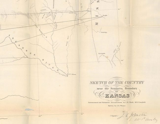
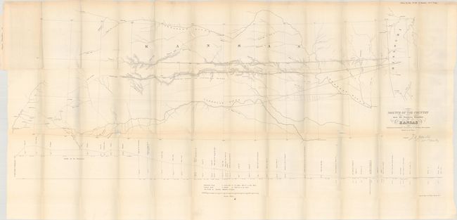
This map describes the important survey that established the southern boundary of Kansas Territory and the feasibility for a southern railroad route. The survey was conducted by Col. Joseph E. Johnson with the map drawn by his assistant, J.E. Weyss. It covers the region from Neosho, Missouri to Albuquerque, New Mexico and includes topographic features and good detail. It locates forts, identifies the Santa Fe Trail as the Santa Fe Road, shows the route of Lt. Whipple in 1853, Aubrey's Trail (an important cattle trail), and names Old Fort Scott, Ft. Union, Raton Pass and Santa Fe. At bottom is a profile of elevations by Dr. Wizlizenus.
References: Wagner & Camp #301a.
Condition: B
Issued folding with numerous splits at the fold junctions and a tiny amount of image loss. There is faint offsetting and a 3" fold separation at left that has been closed on verso with archival tape.